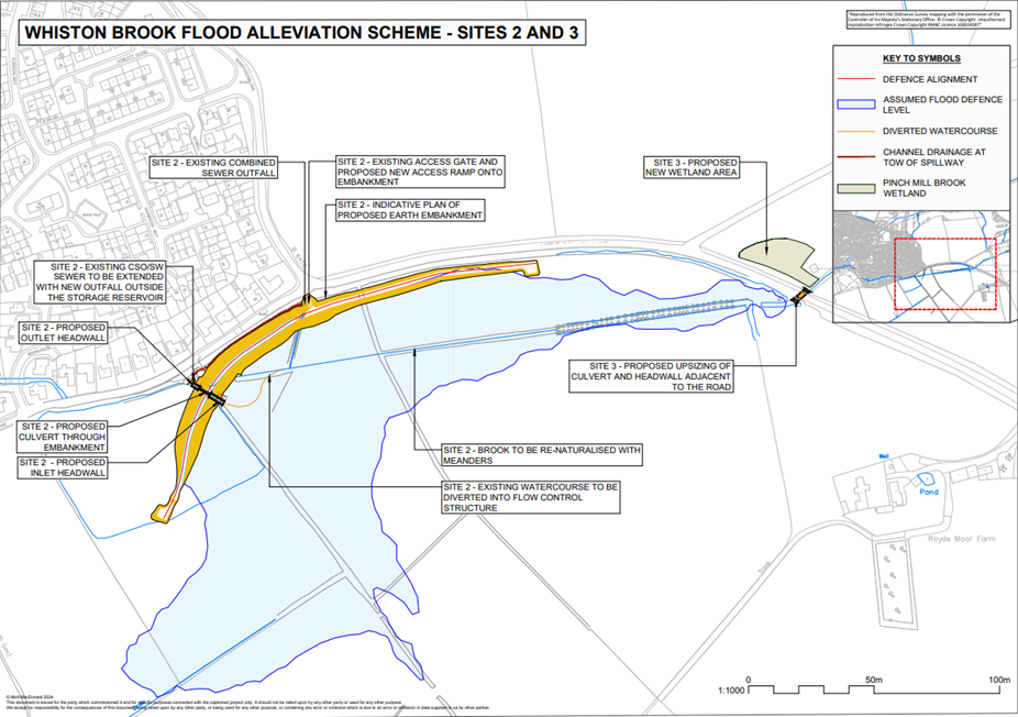
Building an embankment around Moorhouse Lane and Little Common Lane to form a Flood Storage Reservoir (FSR) that will collect floodwater during flood events. The works will also include the realignment and diversion of the main Whiston Brook Channel to align with the proposed reservoir.
About Site 3
Upsizing Royds Moor Culvert: The existing B6410 (Royds Moor Hill) is proposed to be replaced with a new and larger concrete box bridge that will allow increased water flows and reduce incidences of overtopping the B6410 during flood events.
Pinch Hill Brook wetland area: The right floodplain of Pinch Mill Brook is proposed to become a wetland to counteract the backwater impact of the reservoir basin during high flow events. The wetland would be connected to the main Whiston Brook channel via an overflow channel.