Drawing 1
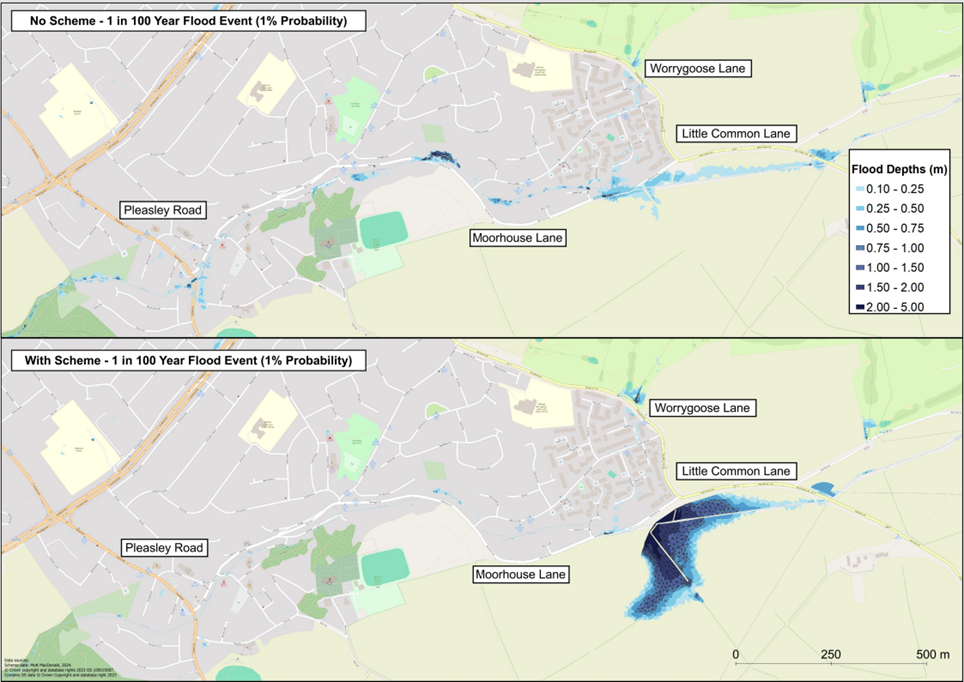
Drawing 1 shows the location and extents of the flood depths across Whiston for a flood event which has a 1% chance of happening each year.
The top image is with no scheme and the bottom image is with the proposed scheme.
Drawing 1 shows the location and extents of the flood depths across Whiston for a flood event which has a 1% chance of happening each year.
The top image is with no scheme and the bottom image is with the proposed scheme.


Hi, I'm Bailey, how can I help you today? You can ask me questions relating to a number of council services.
To start a chat you will need to click 'continue' to confirm you have read and understood our terms and conditions Privacy Policy.